[LUM#22] In Search of the Lost Glaciers
To study glaciers, geologists rely on satellite imagery. This is a time-consuming and tedious process, but Isabelle Rocamora aims to simplify it by developing the very first deep learning model dedicated to mapping glacial moraines.
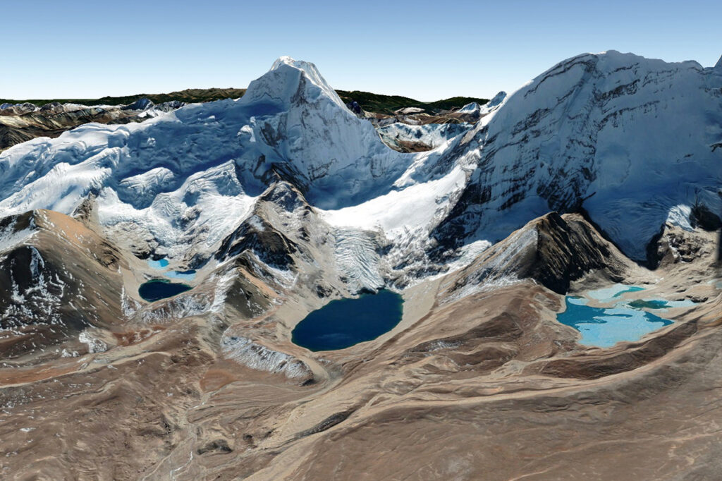
Most of the fresh water on the surface of our planet is found neither in rivers nor in lakes, but in glaciers. Although there are still nearly 200,000 of them, many have disappeared, and those that remain are melting like snow in the sun. During the 20th century, glacier coverage decreased by 30 to 40 percent in the Alps, by 75 percent in the Pyrenees, and by more than 80 percent in certain tropical mountain ranges such as the Andes and Kilimanjaro.
Glaciers that, as they retreat, still leave a trace of their passage: geological formations called moraines. “It’s a pile of rock debris carried along by the glacier’s movement and accumulated at the bottom and on the sides, ” explains Isabelle Rocamora. “It’s like when you push sand with your hand and then pull it away—it leaves ridges of sand in front and along the edges,” illustrates the doctoral student, who is conducting interdisciplinary research between the Géosciences Montpellier1 and Tetis, under the supervision of Matthieu Ferry and Dino Ienco. Mapping these moraines therefore provides valuable information, particularly regarding glacial retreat.
Automate tasks
A necessary but particularly time-consuming task: “To create this map, we’ll take measurements in the field and then look for glacial moraines in satellite images, which provide a broader view, ” explains the geologist. To save time, she proposes automating this task using artificial intelligence. “I’ve developed an algorithm that analyzes satellite images; it’s the first deep learning model dedicated to mapping glacial moraines.”
To teach her software—called MorNet—to distinguish a moraine from other rock formations, Isabelle Rocamora began by creating a “traditional” map using satellite images of the Himalayas acquired by the CNES’s Pléiades satellite. “I then fed these maps into the software, telling it, ‘this is a moraine’ or ‘this is not a moraine.’ ” The model then identified the common characteristics among the samples in order to learn on its own how to identify a moraine in satellite images. “A computer doesn’t ‘see’ things the way a human does, so rather than giving it human-generated answers, we’ll let it figure out its own identification rules, ” explains Isabelle Rocamora.
Background Information
To measure MorNet’s performance, the geologist then compared her own mapping to that produced by the artificial intelligence. While MorNet proved effective at recognizing moraine ridges, it is less accurate at identifying their flanks; in other words, the model knows where these geomorphological features are located but struggles to delineate them clearly. And for good reason: a moraine is defined not only by its shape but also by its formation pattern, and MorNet cannot discern this; to improve it, therefore, it would need to be provided with contextual information. “While deep learning saves time, mapping still requires the expertise of a geomorphologist to confirm and refine the machine’s conclusions, ” concludes Isabelle Rocamora.
Check out theUM podcasts, now available on your favorite platform (Spotify, Deezer, Apple Podcasts, Amazon Music, etc.).
- GM (UM, CNRS, University of the Antilles)
↩︎