Most industrial fishing in marine protected areas goes unmonitored
Are marine protected areas truly effective in protecting marine life and small-scale fisheries? While, following UNOC-3, countries such as France and Greece have announced the creation of new areas, a study published on July 24 in the journal *Science* shows that the majority of these zones remain exposed to industrial fishing, much of which escapes public oversight. A large portion of marine protected areas do not comply with scientific recommendations and offer little, if any, protection for marine life.
Raphael Seguin, University of Montpellier and David Mouillot, University of Montpellier
The health of the ocean is at risk, and by extension, so is ours. The ocean regulates the climate and rainfall patterns, feeds more than three billion people, and supports our cultural traditions and economies.
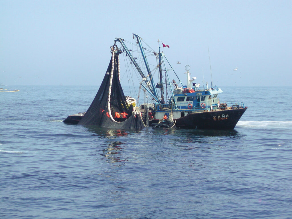
Historically, industrial fishing has been the primary cause of marine life destruction: more than a third of fish stocks are overfished—a figure that is likely an underestimate—and populations of large fish have declined by 90 to 99 percent, depending on the region.
Added to this today is climate change, which is having a significant impact on most marine ecosystems, as well as new pressures—the full extent of which is not yet fully understood—linked to the development of offshore renewable energy, aquaculture, and mining.
Marine Protected Areas: An Effective Tool for Protecting the Ocean and People
In the face of these threats, we have a proven tool for protecting and restoring marine life: marine protected areas (MPAs). The principle is simple: we are overexploiting the ocean, so we must designate certain areas where we can regulate—or even ban—activities that have a negative impact, allowing marine life to recover.
MPAs aim to achieve threefold effectiveness: ecological, social, and climate-related. They facilitate the recovery of marine ecosystems and the fish populations that can reproduce within them. Some allow only small-scale fishing, creating no-competition zones that protect more environmentally friendly methods and create jobs. They also allow for recreational activities, such as scuba diving. Finally, they protect environments that storeCO2 and thus contribute to climate regulation.

Underthe Kunming-Montreal Global Agreement signed at COP 15 on biodiversity, countries have committed to protecting 30% of the ocean by 2030. Officially, more than 9% of the ocean’s surface is currently protected.
To be effective, all MPAs should, according to scientific recommendations, either ban industrial fishing and exclude all human activities, or allow certain activities, such as small-scale fishing or scuba diving, depending on the level of protection. In practice, however, a large proportion of MPAs do not follow these recommendations and do not exclude industrial activities that are the most destructive to marine ecosystems, making them ineffective or even completely ineffective.
Real protection or a marketing tool?
In fact, in order to quickly meet international conservation targets and claim political victory, governments often establish large protected areas on paper, but without any real protection on the ground. For example, France claims to protect more than 33% of its waters, but only 4% of them are subject to regulations and enjoy a truly effective level of protection, including just 0.1% in its mainland waters.
At the UN Ocean Summit held in Nice in June 2025, France— which also opposes European regulations aimed at banning bottom trawling in MPAs—announced that it would designate 4% of its metropolitan waters as high-protection areas and ban trawling there. The problem is that nearly all of these areas are located in deep waters… where bottom trawling is already prohibited.
The situation is therefore critical: in the European Union, 80% of marine protected areas do not prohibit industrial activities. Worse still, the intensity of bottom trawling is even higher in these areas than outside them. Globally, most MPAs allow fishing, and only one-third of large MPAs are truly protected.
Furthermore, the true extent of industrial fishing in MPAs remains largely unknown on a global scale. Our study therefore sought to help fill this gap.
The Reality of Industrial Fishing in Protected Areas
Historically, it has always been very difficult to know where and when fishing vessels go to fish. This made it very difficult for scientists to monitor industrial fishing and its impacts. A few years ago, the NGO Global Fishing Watch published a dataset based on the Automatic Identification System (AIS), a system originally designed for safety purposes, which makes the location of large fishing vessels around the world publicly and transparently available. In the European Union, this system is mandatory for all vessels over 15 meters in length.
The problem is that most fishing vessels do not constantly transmit their position via the AIS system. There are various reasons for this: they are not necessarily required to do so, the vessel may be in an area where satellite reception is poor, and some deliberately turn it off to conceal their activities.
To address this gap in knowledge, Global Fishing Watch has combined this AIS data with satellite imagery from the Sentinel-1 program, which can detect vessels. This allows us to distinguish between vessels tracked by AIS and those that are not tracked by AIS but are detected in the satellite imagery.

The fishing grounds are productive, but that’s because they’re located in areas where few boats go fishing to begin with
Our study examines the presence of fishing vessels, whether or not tracked by AIS, in more than 3,000 coastal marine protected areas (MPAs) worldwide between 2022 and 2024. During this period, two-thirds of industrial fishing vessels present in MPAs were not publicly tracked by AIS, a proportion equivalent to that observed in unprotected areas. This proportion varied from country to country, but unmonitored fishing vessels were also present in the marine protected areas of EU member states, where the transmission of position via AIS is nevertheless mandatory.
Between 2022 and 2024, we detected industrial fishing vessels in half of the MPAs studied. Our findings, consistent with another study published in the same issue of the journal Science, show that the presence of industrial fishing vessels was indeed lower in truly protected MPAs—the rare ones that prohibit all extraction activities. This is good news: when regulations exist and are effectively enforced, MPAs successfully exclude industrial fishing.
Instead, we sought to understand the factors influencing the presence or absence of industrial fishing vessels in MPAs: is it the actual level of protection, the MPA’s location, its depth, or its distance from the coast? Our results indicate that the absence of industrial fishing in an MPA is more closely linked to its strategic location —areas that are very close to shore, remote, or unproductive, and therefore difficult to exploit—than to its level of protection. This reveals an opportunistic strategy in the siting of MPAs, which are often placed in areas with little fishing activity in order to more easily meet international targets.

A little-known and underrated sport
Finally, one question remained: does the detection of a fishing vessel on a satellite image necessarily mean that the vessel is actually fishing, or is it simply in transit? To answer this, we compared the number of vessel detections from satellite images within a MPA to its known fishing activity, as estimated by Global Fishing Watch using AIS data. If the two indicators are correlated, and if the number of vessel detections on satellite images is linked to a greater number of fishing hours, this implies that it is possible to estimate the proportion of “invisible” fishing activity based on detections not tracked by AIS.
We found that the two indicators were highly correlated, demonstrating that satellite detections are a reliable indicator of fishing activity within a MPA. This reveals that industrial fishing in MPAs is far more extensive than previously estimated—by at least one-third, according to our results. Yet most research and conservation organizations, NGOs, and journalists rely on this single source of public and transparent data, which reflects only a limited part of the reality.
Many questions remain: the resolution of satellite imagery prevents us from seeing vessels shorter than 15 meters and misses a significant portion of vessels between 15 and 30 meters. Our results therefore underestimate industrial fishing in protected areas and completely overlook small vessels under 15 meters in length, which can also be considered industrial fishing, particularly if they adopt industrial methods such as bottom trawling. Furthermore, the satellite imagery used covers most coastal waters but not the majority of the high seas. Island or offshore MPAs are therefore not included in this study.
Toward Effective Ocean Protection
Our findings are consistent with those of other studies on the subject and lead us to make three recommendations.
On the one hand, the number of marine protected areas does not determine their quality. The definitions of MPAs must follow scientific recommendations and prohibit industrial fishing; otherwise, they should not be considered true MPAs. Furthermore, MPAs must also be located in areas under fishing pressure, not just in underutilized areas. Finally, fisheries monitoring must be strengthened and made more transparent, particularly by expanding the use of AIS on a global scale.
In the future, thanks to high-resolution optical satellite imagery, we will also be able to detect even the smallest fishing vessels, giving us a broader and more comprehensive view of fishing activities around the world.
For now, the urgent priority is to align the definitions of marine protected areas with scientific recommendations and to systematically ban industrial activities within these areas, in order to establish effective protection for the ocean.
Raphael Seguin, PhD candidate in marine ecology, conducting his research with the University of Montpellier and BLOOM, University of Montpellier and David Mouillot, Professor of Ecology, MARBEC Laboratory, University of Montpellier
This article is republished from The Conversation under a Creative Commons license. Readthe original article.