[LUM#2] Nanosats, Big Picture
Designed by students at theUM, the nanosatellites from the University Space Center (CSU) in Montpellier could help better anticipate “Mediterranean episodes,” which are expected to become more frequent.
September 29, 2014. The Mediterranean coast is on alert. For several days now, weather forecasts have been predicting the arrival of a “Mediterranean episode”—a stormy weather pattern typical of the Gulf of Lion area, caused by the electrically charged collision between an oceanic low-pressure system and warm currents from the Mediterranean. Within a few hours, the equivalent of several months’ worth of rain will pour down on the Montpellier region. But exactly when? No one can say for sure.
Weather Reports
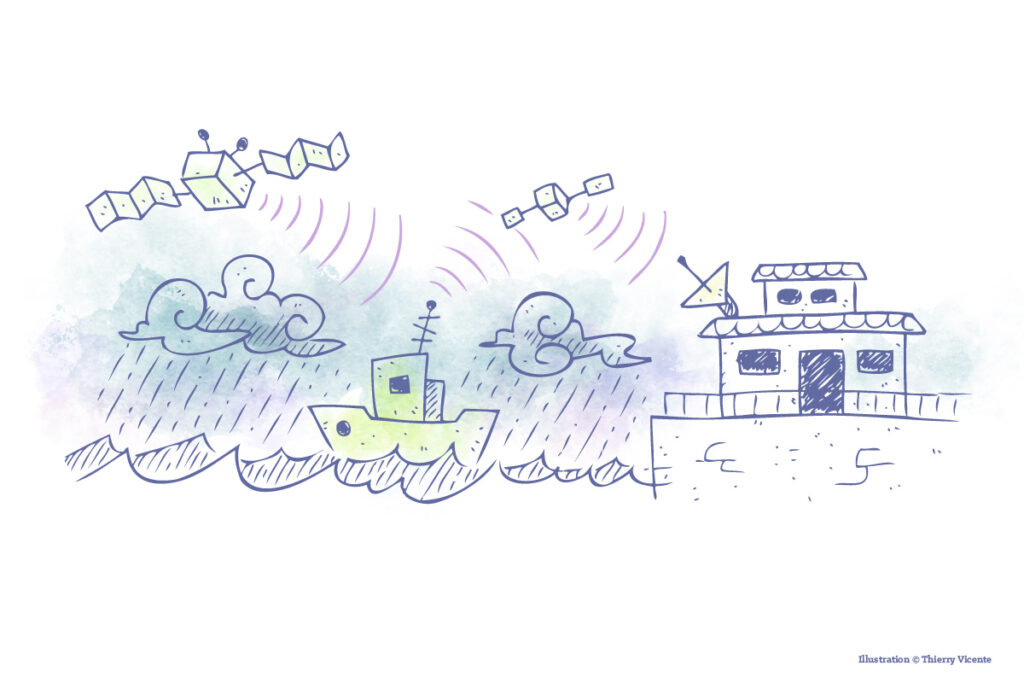
This is where Robusta 3-A could come into play—a small cube of technology floating in perfect tranquility several hundred kilometers away. While the laws of physics prevent the nanosatellite from carrying the optical instruments used by Météo France’s satellites, it could still be useful in other ways. “We now need to improve forecasts for very localized areas. This requires a dedicated system that Météo France does not have,” explains Laurent Dusseau. For nanosatellites, however, this is a tailor-made solution.
The project, scheduled to launch in 2018, would consist of three phases. First phase: GPS signals from “traditional” satellites are collected by mini-weather stations deployed at sea aboard cargo ships.“Based on how these signals propagate through the atmosphere, we can estimate the amount of water vapor present above the ship,” explains the CSU director. This data is then transmitted to the nanosatellite, which relays it to a ground station, where it will be used to develop predictive models. By serving as a relay, Robusta 3-A could help create accurate maps that enable more detailed—and, above all, up-to-date—monitoring of the storm.
A tropical Languedoc?
This technological marvel, measuring just a few centimeters on each side, has another advantage: its price. A few hundred thousand euros—about a hundred times less than a large geostationary satellite. That’s not surprising for a satellite designed entirely by students: “They manage the projects from start to finish,” explains Frédéric Saigné. “From the DUT through postdoctoral studies, each level of study is supervised by the next higher level,” adds the director of the Van Allen Foundation.
A foundation that brings together industrial leaders and major space agencies to take student projects all the way up to the stars. A large-scale consortium capable of addressing the challenges posed by these Mediterranean weather events, which experts predict will intensify, with rainfall that could reach up to 1,000 mm in a single day—precipitation levels typical of a tropical climate.
See also:
Check out theUM podcasts, now available on your favorite platform (Spotify, Deezer, Apple Podcasts, Amazon Music, etc.).